Inquiry #8 – Bike Packing Wrap Up
This inquiry project this semester has been a really awesome opportunity to explore a topic (bike packing) that I’ve been interested in for a long time. I have learned a lot, and above all found some tangible inspiration to get out there this summer. I was hoping to complete an overnight trip before the end of the semester, but weather and a limited amount of weekends impeded that. A friend just got a new bike, so now there are 3 of us who are excited to hit the ol dusty trail and find some camping spots. I am grateful for the opportunity to test out my new bike, look at my gear through a bike packing lens, and explore some potential routes for my first trip.
I asked ChatGPT to provide the top 3 bike packing routes for southern Vancouver Island. Here is what it said:
Here are the top 3 beginner-friendly bikepacking routes on southern Vancouver Island (roughly Duncan → Victoria → Sooke → Lake Cowichan), ranked for ease, scenery, and beginner success rate:
🥇 1. Cowichan Valley Trail / Cowichan Valley 8
📍 Duncan ↔ Lake Cowichan
Why it’s #1: This is the gold standard beginner route on Vancouver Island.
Key details:
- Distance: ~100–150 km (loop or out-and-back)
- Duration: 1–3 days
- Terrain: Smooth rail trail (packed gravel)
- Elevation: Very gradual
Why it’s perfect:
- Old railway grade = no steep climbs
- Frequent towns (Duncan, Lake Cowichan) for food + bailouts
- Multiple campsites along the route
- Iconic crossings like the Kinsol Trestle
👉 If you’ve never bikepacked before, start here—it’s the lowest risk, highest reward option.
🥈 2. South Island Sundowner Loop
📍 Greater Victoria → Sooke Hills → Shawnigan Lake
Why it ranks #2: A step up in adventure without becoming overwhelming.
Key details:
- Distance: ~140–150 km
- Duration: 1–2 nights
- Terrain: ~70% gravel + some trail
- Elevation: Moderate
Highlights:
- Coastal riding near Sooke
- Forested climbs in the Sooke Hills
- Lakeside camping (e.g., around Shawnigan Lake)
Beginner considerations:
- Some navigation complexity
- A few rougher sections vs. Cowichan trail
👉 Best as your second trip once you’re comfortable with gear and pacing.
🥉 3. Galloping Goose → Sooke Potholes → Jordan River (Out-and-Back)
📍 Victoria → Sooke → Jordan River
Why it ranks #3: Super accessible, very scenic, and easy to customize.
Key details:
- Distance: ~60–120 km (depending how far you go)
- Duration: 1–2 days
- Terrain: Rail trail + gravel + short pavement sections
- Elevation: Gentle overall
Highlights:
- Ride the Galloping Goose Regional Trail
- Swim spots at Sooke Potholes
- Ocean views near Jordan River
Why it’s great for beginners:
- Starts right from Victoria
- Easy bailout points and cell service
- Flexible distance (turn around anytime)
👉 Perfect for a first overnight with minimal commitment
⚖️ Quick Comparison
| Route | Difficulty | Best For | Vibe |
|---|---|---|---|
| Cowichan Valley Trail | ⭐ Very Easy | First-ever trip | Chill, scenic, safe |
| South Island Sundowner | ⭐⭐ Easy–Moderate | Progression | Adventure + variety |
| Galloping Goose → Jordan River | ⭐ Easy | Short overnighter | Coastal + flexible |
👍 Straight recommendation
- First trip ever? → Cowichan Valley Trail
- Short weekend from Victoria? → Galloping Goose
- Want a real “bikepacking feel”? → Sundowner
I am most inclined to try the Sundowner, as I have wanted to bike to Sooke Potholes for a long time. It kind of reminds me of this route I found on gravelbuddies.com. I love the idea of a swim spot during the ride and a coastal campground. I love Jordan River and have spent a lot of time there, but have never biked that far.
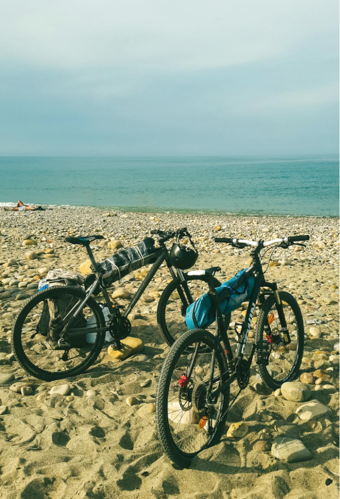
This picture is from Pexels.com showing two bikes on the beach. I picture my Jordan River trip looking a little something like this – maybe more rocks and less sand.
I then asked ChatGPT to give me a quick overview of a Pender Island trip, because that is another one I would love to do this summer. Here is what it said:
Pender Island Loop (North + South)
📍 Pender Island
Slightly more rugged feel, but still very manageable.
Key details:
- Distance: ~50–90 km
- Duration: 1–2 days
- Terrain: Paved + gravel mix
- Difficulty: ⭐ Easy–Moderate (short but punchy hills)
Why it’s great:
- Less busy than Salt Spring
- Beautiful coastal viewpoints
- Easy to connect North & South via bridge
- Camping at places like Prior Centennial Campground
Beginner notes:
- Hills are steeper but shorter
- Fewer services → plan food ahead
👉 Perfect if you want quiet island vibes with a bit more adventure
This sounds like an accessible, fun, and scenic trip I could do this summer.
Overall, I am very excited for the trips to come and grateful for the opportunity to write this blog and inquire more about bike packing! I have watched lots of inspiring YouTube videos, talked to friends, and daydreamed about the fun times to be had.
See you out there on the trails!
-Astrid
The plan sounds great. I never did an overnight trip, just rode the area. I did the Kinsol Trestle a few times, given that it was a 30-minute ride from where I lived. It was worth it, particularly after they rebuilt it (I did the original, creaky one). Thanks for taking me along the way. For me, it was a nostalgic trip back, as my 2-wheel days are done right now. We are all steep hills on a cliff, and no real back roads, just a scary 2-lane highway with little to no bike lane or shoulder. I walk and hike now only.